[google-translator]
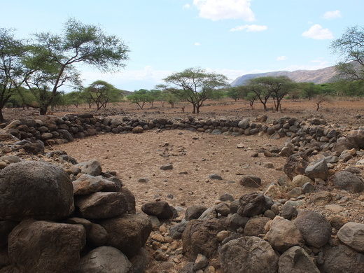
Engaruka, situated 63 km north of Mto wa Mbu, on the road to Oldonyo Lengai and Lake Natron lies at the foot of the Rift Valley escarpment. It is an important historic site as some 500 years ago, a farming community of several thousand people chose to develop an indigenous irrigation and cultivation system here. For unknown reasons, the farmers left Engaruka around 1700, but the ruins speak volumes about the highly specialized agricultural economy.
Measures were taken to prevent soil erosion and the fertility of the plots was increased by using the manure of stall fed cattle.
The site still poses many questions, including the identity of the founders, how they developed such an ingenious farming system, and why they left. The site has been linked to the Sonjo, a people living some 60 miles to the northwest known for their use of irrigation systems in agriculture and similar terraced village. New studies have revealed lot of unknown perspectives of the past of Engaruka, for example the Middle Stone Age and Neolithic Stone Age occupation history of the area.
The first explorer to record the existence of these ruins was Dr. Gustav Fisher, who passed them on July 5, 1883, and compared them to the tumbled-down walls of ancient castles. Drs Scoeller and Kaiser mentioned the ruins of “Ngaruku including great stone circles and dams in 1896-97. The first detailed and archaeological investigation was by Hans Reck, in 1913.
This is the end of our “”
Thank you for your interest to our programs. We hope that you will use the form below to book your safari with Travel Closer
Note: We can customize this program to carter your budget and safari expectations
PRICING TERMS
Price Includes:
|
Price Excludes:
|

